


More than two years (November 2019!) since Apple’s kitted out Subaru Imprezas hit the road in Australia (and a pandemic and a half later), Apple has flicked the switch on their new maps in Australia.
Australia is the latest country to experience the ‘new’ redesigned Maps, with US, UK, Ireland, Canada, Spain, Portugal and Italy enjoying it over the past few years. And it’s available on iPhone, iPad and on macOS
We all remember the horror stories from when Apple said goodbye to Google and launched Apple Maps as part of iOS 12 in 2012 – like people getting stranded on the way to Mildura – that prompted Tim Cook to write an apology letter.
Thankfully things have very much improved since 2012, with the Maps app continually getting tweaked, new features added (like public transport directions, or ratings and photos at places), and it slowly making it’s way to places other than the iPhone (did you know DuckDuckGo uses Apple Maps for search results?).
In 2018, Eddy Cue announced that Apple would be rebuilding maps from the ground up – and now Australia is lucky enough to enjoy!
Originally Apple used a mish-mash of sources, for everything from locations of interest (ie, you’d get a list of businesses from one place, another list from another source) to roads and routing. Before today, Apple actually used TomTom data for roads. (ie, make changes via TomTom’s ‘MapShare’ feature, and they’d appear in Apple Maps a few weeks later)
But as of today – it’s all Apple’s data. Apple has spent the last few years driving thousands of kilometres around Australia, satellite imagery, collecting aerial photography and data – plus a few kilometres on foot with backpacks around cities too!
The end result?
Maps now features more detailed road coverage, better navigation, three-dimensional landmarks, and incredible features like Look Around, Share ETA, and more
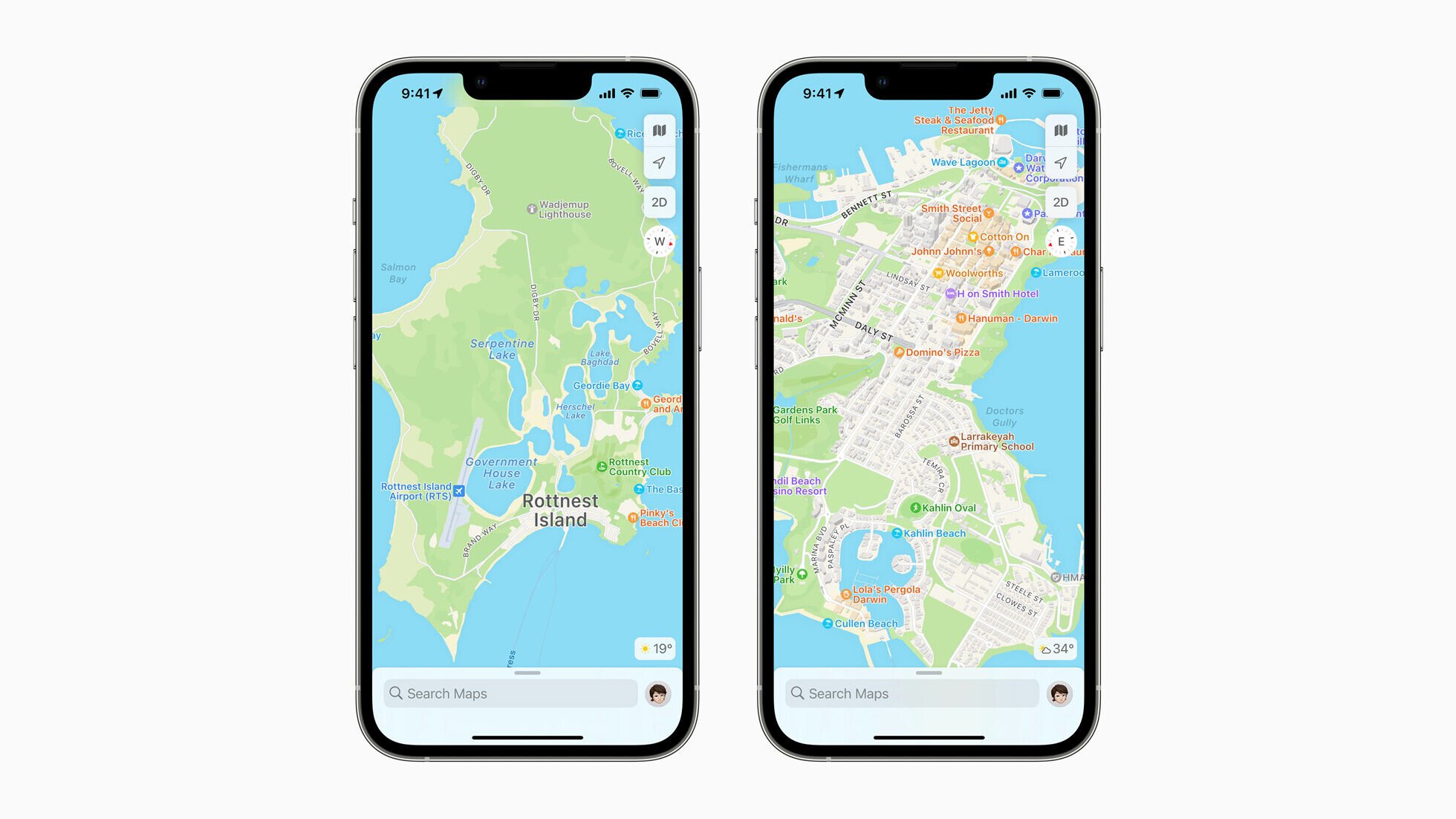
The map is noticeably more detailed – just look at land cover & vegetation; goodbye what used to be grey – hello green! Even the smaller things – beaches have sand, running tracks and sports fields, and everyone’s favourite features on the golf course.
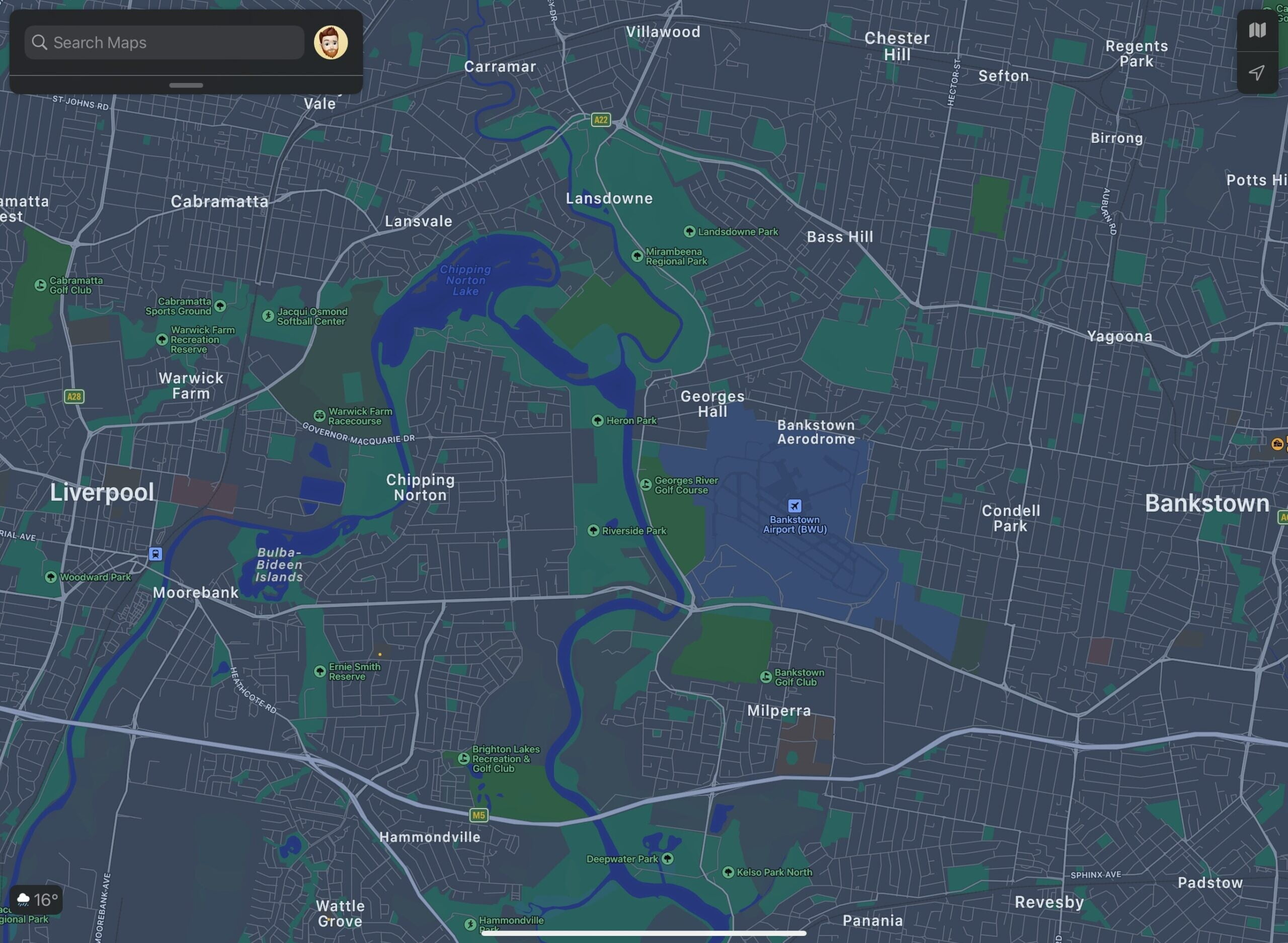
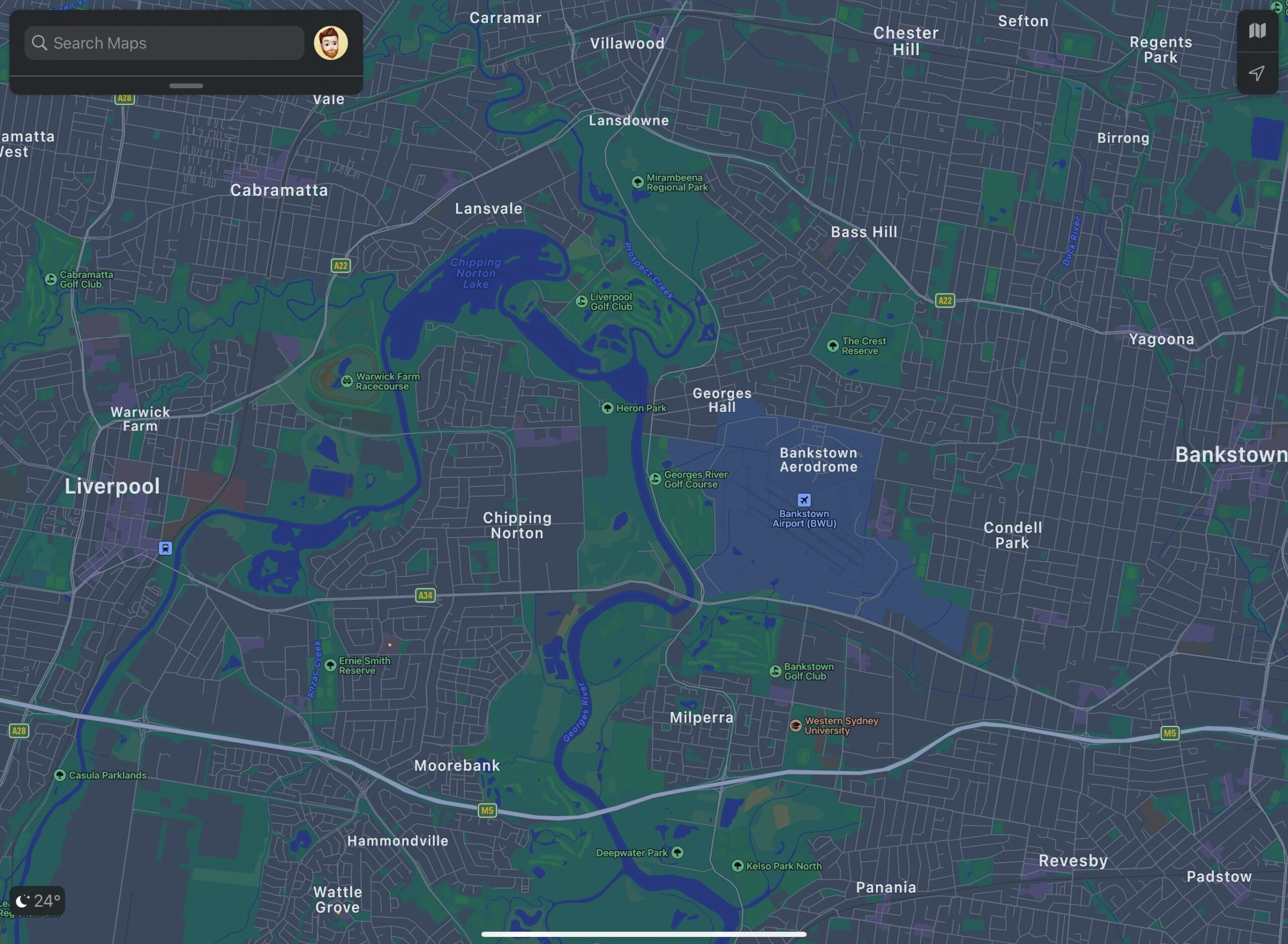
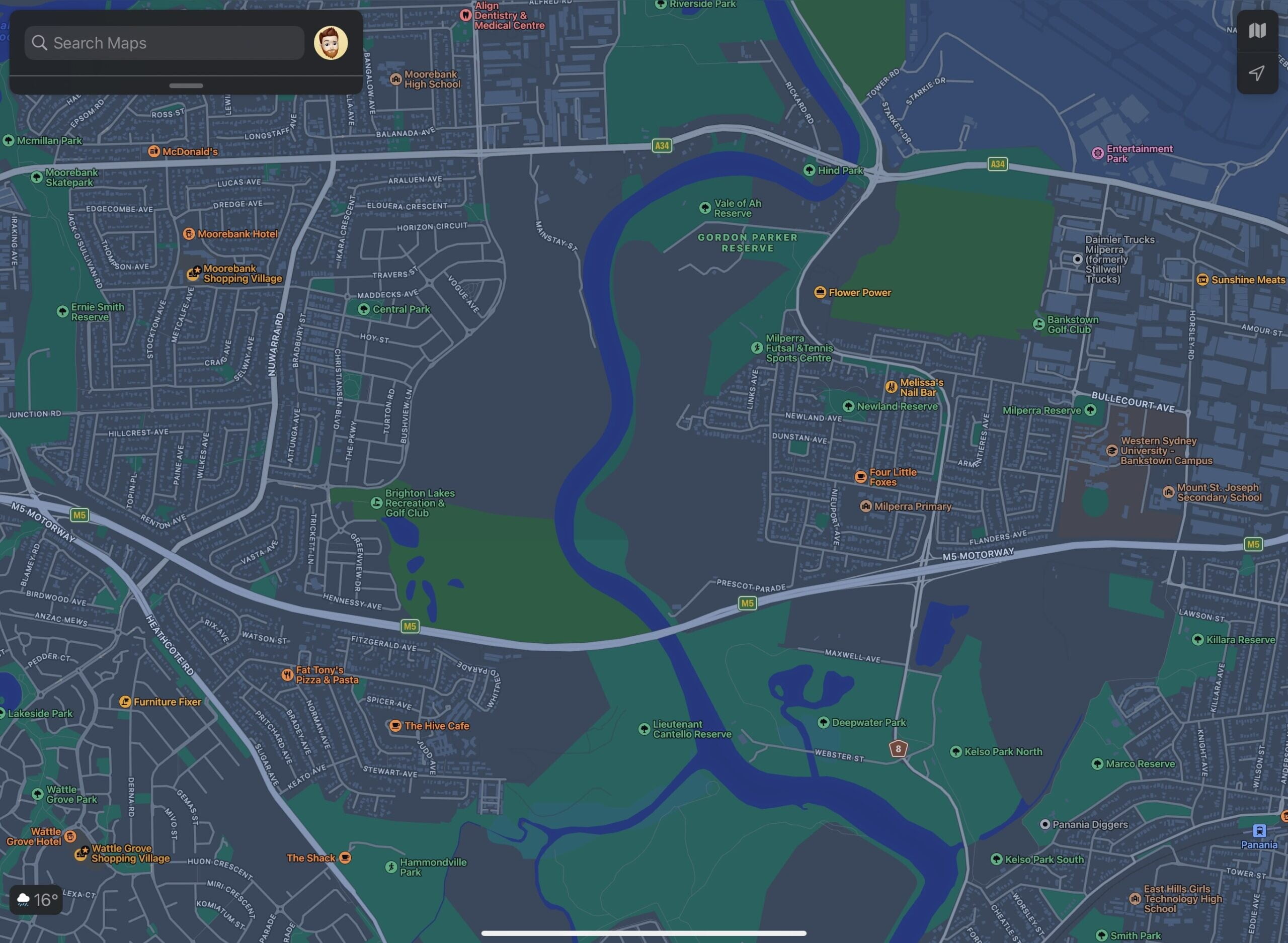
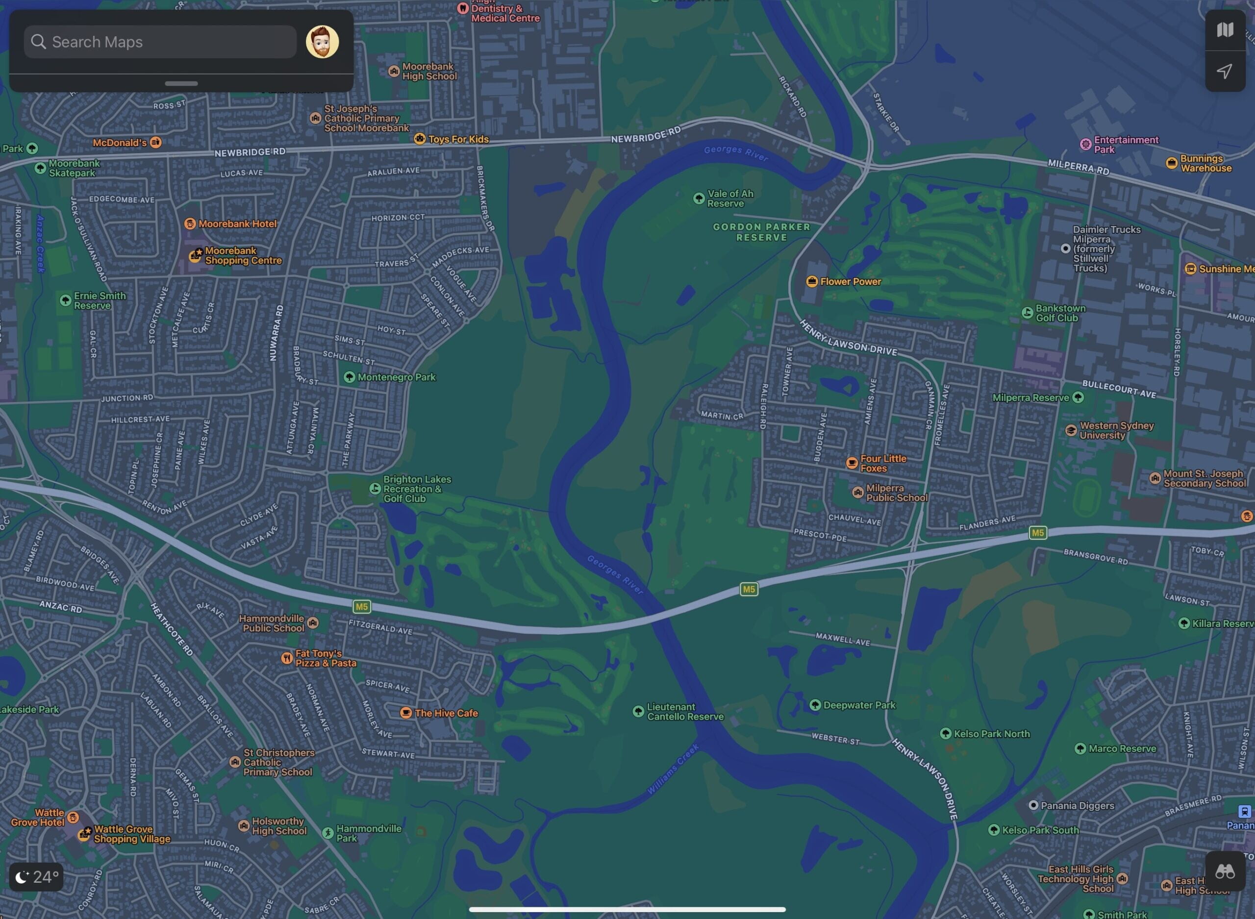
Here’s a few examples I managed to capture – part of some Western Sydney suburbs, between Bankstown and Liverpool – the ‘old’ Apple Maps on the left and the ‘new’ on the right.
(psst, Justin O’Beirne has great comparison shots from elsewhere than Sydney – check them out here)
Let’s get closer – if we take a closer look around Moorebank – see the difference in the vegetation, golf courses and parks?
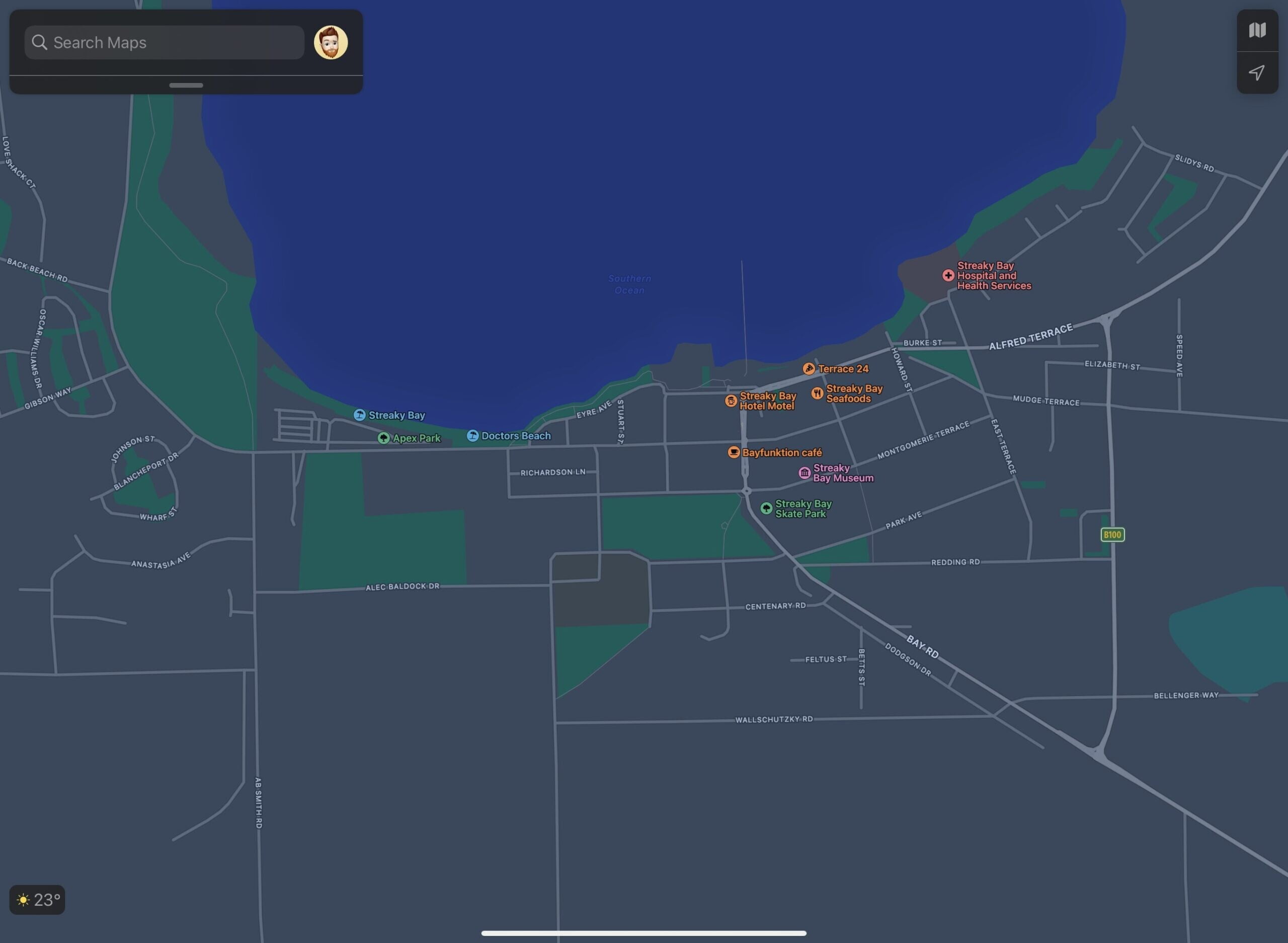
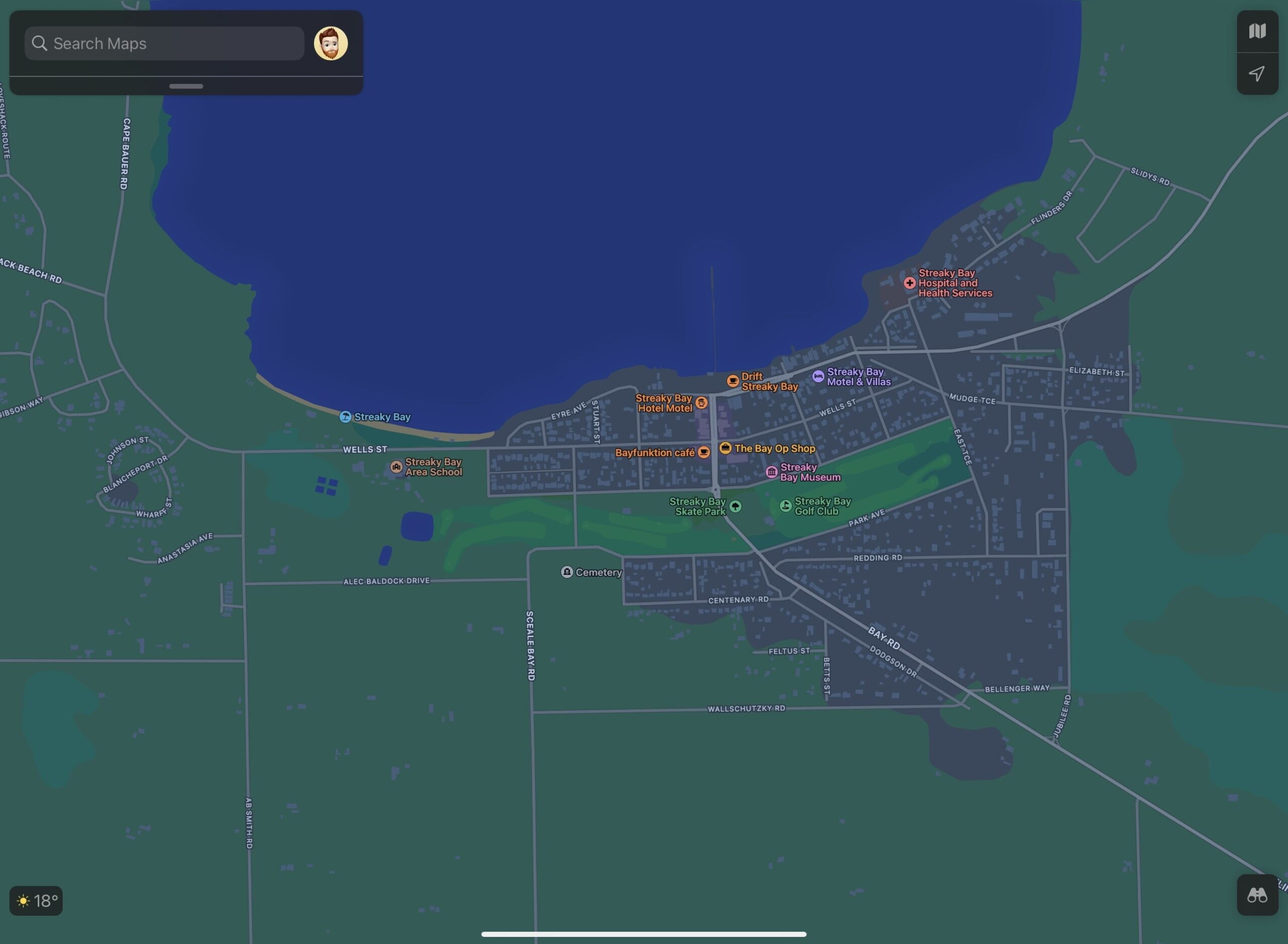
And this isn’t limited to the big cities either – it’s not just Sydney, Melbourne, Adelaide and so on – it’s the whole of Australia. Check out my tiny home town of Streaky Bay (population ~2,000) in South Australia – even the tiny golf course is no longer grey!
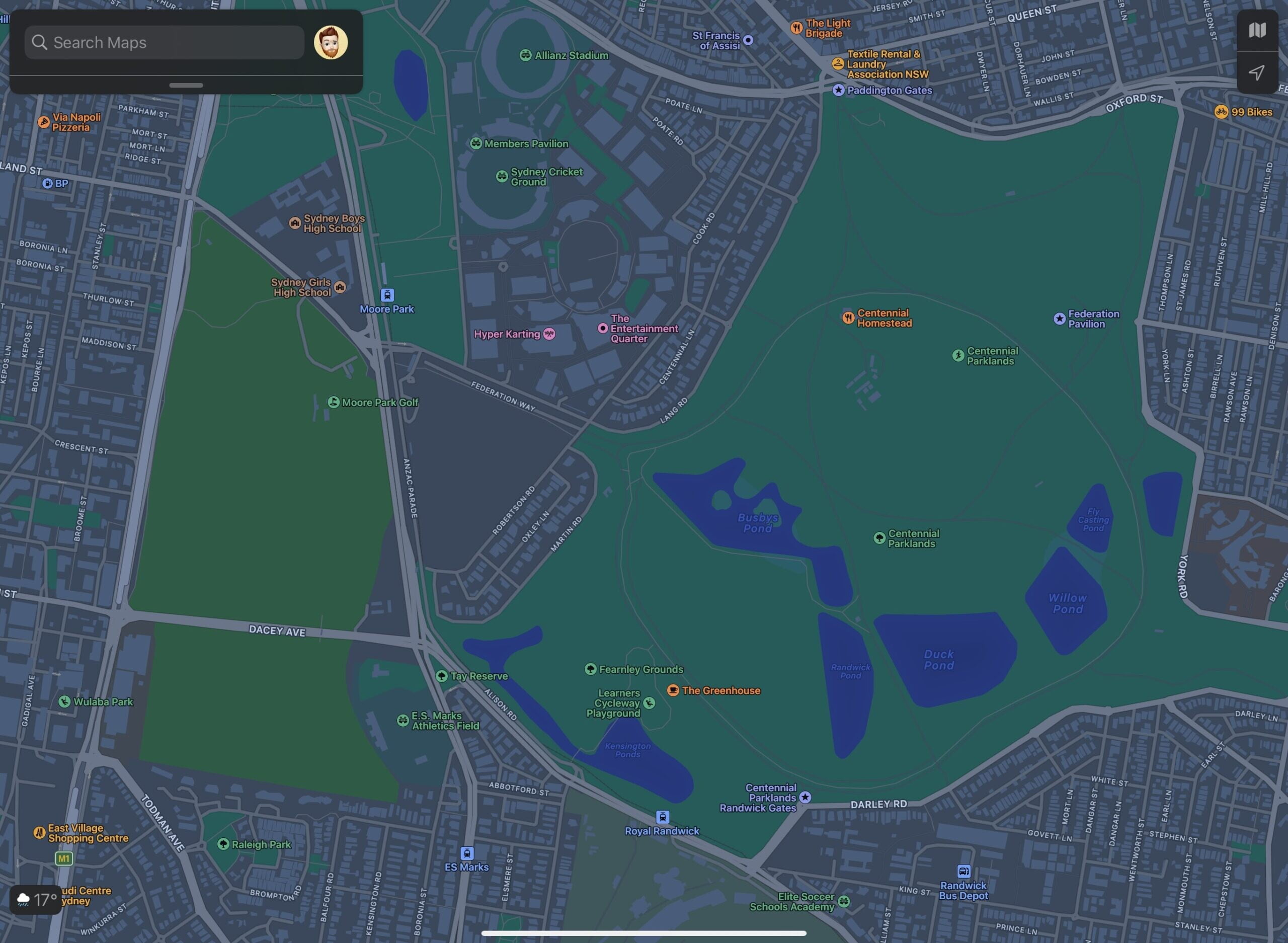
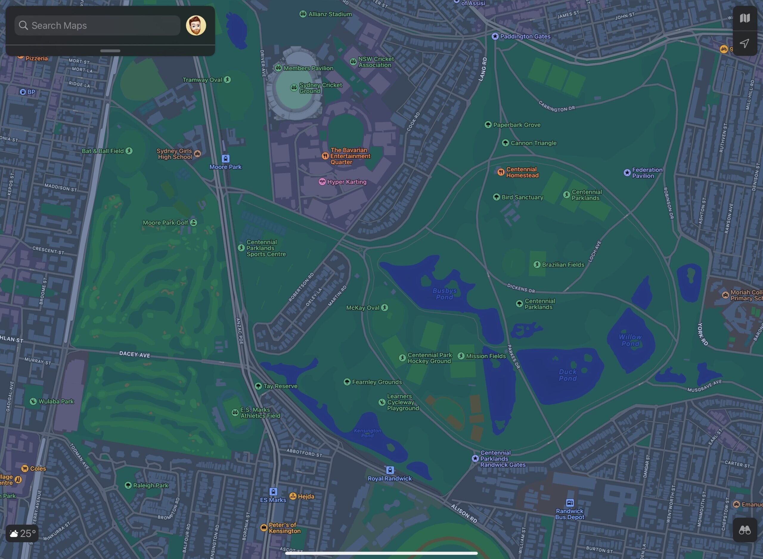
And if we take a look around the other side of Sydney – can you spot the before and after around Moore Park? Take in the Centennial Parklands, Entertainment Quarter and Moore Park Golf….
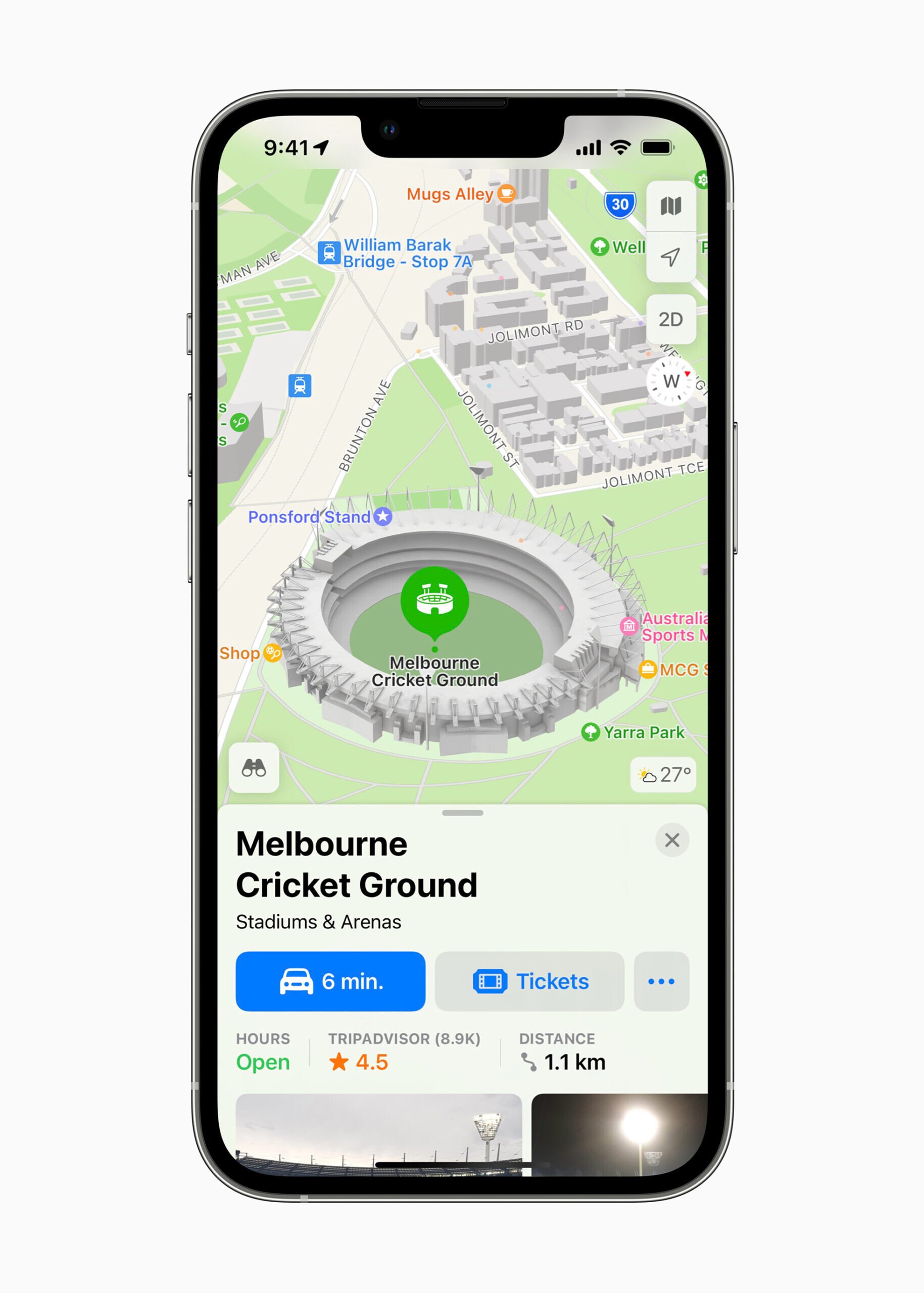
Detailed hand drawn 3D models (yes, they’re not computer generated) also exist for key landmarks – from the Sydney Opera House, Parliament House, through to sports stadiums like the Melbourne Cricket Ground and Stadium Australia.
Here’s a list of 3D landmarks (via Reddit) – click or tap to take a look;
Melbourne
AAMI Park
Arts Centre
Federation Square
Hamer Hall
Melbourne Cricket Ground
Marvel Stadium
Melbourne Museum
Parliament of Victoria
Royal Exhibition Building
Shrine of Remembrance
St. Paul’s Cathedral
St. Patricks Cathedral
Brisbane
Brisbane City Hall
Gabba
Queensland Parliament
Suncorp Stadium
Gold Coast
Q1 Tower
Darwin
Parliament House
Hobart
Parliament of Tasmania
Sydney
ANZAC Memorial
Parliament of NSW
Stadium Australia
State Library of NSW
Sydney Cricket Ground
Sydney Opera House
Canberra
Australian War Memorial
National Carillon
National Library of Australia
National Museum of Australia
Parliament of Australia (Parliament House)
Telstra Tower
Adelaide
Adelaide Oval
St. Francis Xavier’s Catholic Cathedral
St. Peter’s Cathedral
Perth
Bell Tower
Optus Stadium
Parliament House
RAC Arena
St. Mary’s Cathedral
WA Maritime Museum
Where Google has ‘Street View’, Apple has ‘Look Around’. Yes it’s basically the same thing – they’ve used the thousands of kilometres of driving across Australia, and some photos taken on foot – to make a really polished alternative to Street View.
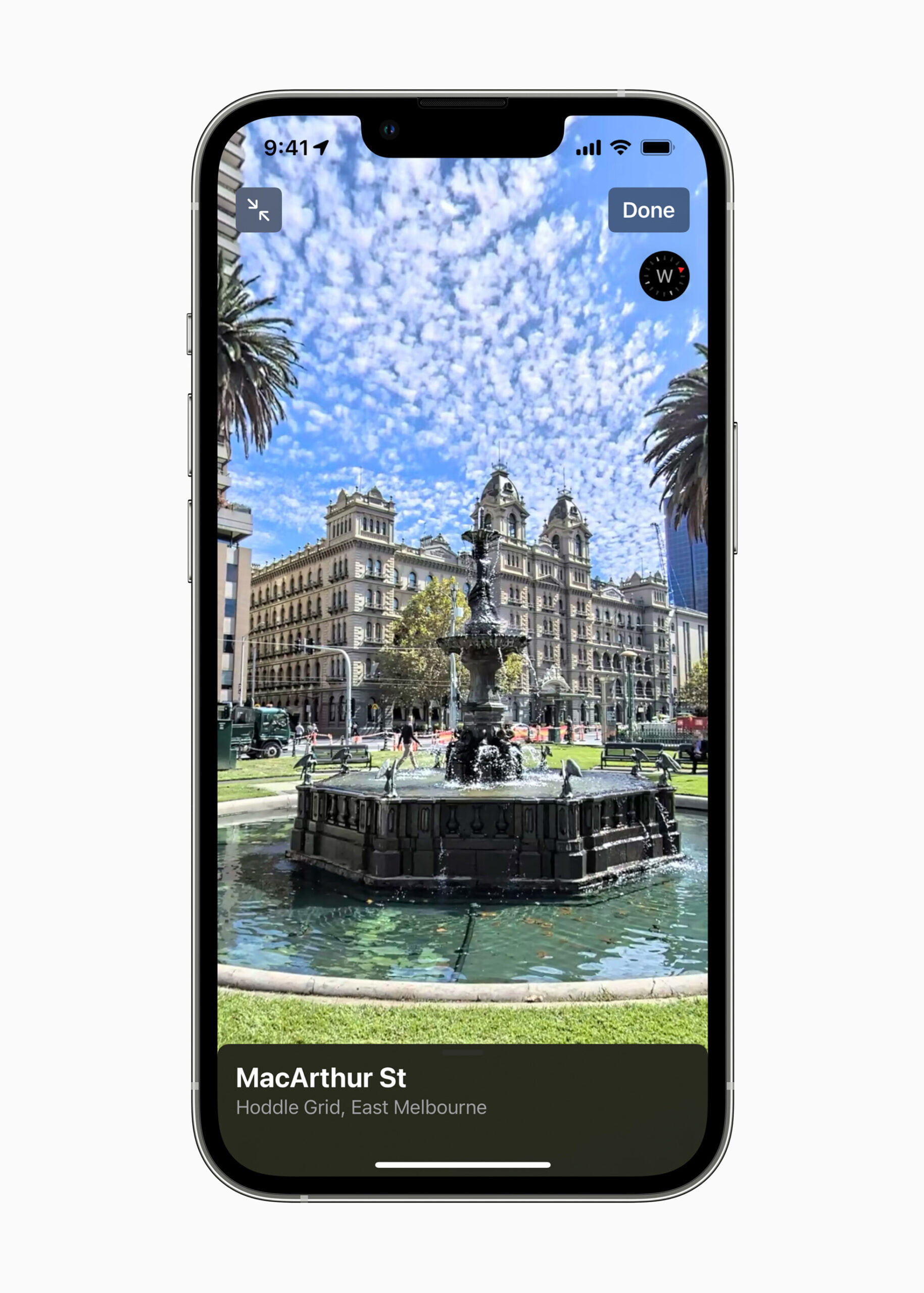
Look Around has this really cool 3D-ish effect when panning around you, and when ‘stepping’ forward to another spot on the map – it is a litte more ‘animated’ than Street View – which tends to ‘jump’ straight to that spot. You’ll get what I mean when you try it out.
‘Pedestrian’ collection is a bit all over the place – the CBDs are covered (so you can ‘walk’ down George Street Mall and check out the Apple Sydney store), and some other parks are as well (give your feet a rest and walk around Sydney Park in Look Around).
Coverage seems fairly equal to Google’s Street View – unsealed roads were not driven on (but it looks like Street View’s unsealed roads haven’t been mapped in quite some time), and with imagery taken between December 2019 and June 2021, sometimes you’ll time travel when moving around.
(Apple is already driving and walking around Australia again, with image collection happening from November 2021 through to April 2022)
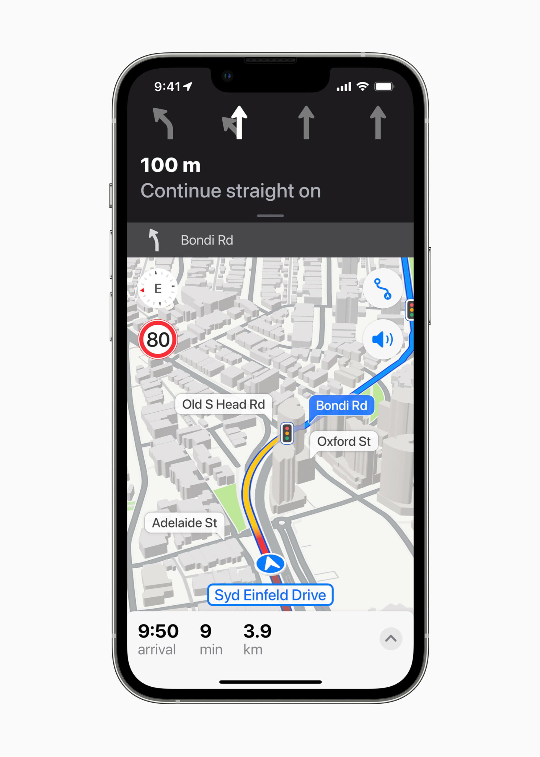
One of the other really nice changes that come with Apple Maps – far more ‘natural’ directions to make them easier to follow, and take the right turn!
Instructions like ‘In 500 metres, turn left on to George Street‘, have been swapped out with ‘Go past these lights, then at the next set, turn left‘. Those traffic lights also appear on the map when getting guidance.
Stop signs are included too – making it easier to follow (at the stop sign, turn right) – as well as shown on the map.
Speed limits can also be displayed – though don’t appear on every road – as well as warnings for speed cameras and red light cameras. Apple won’t tell you your current speed though, so that’s one thing Waze still has.
One last thing – immersive walking directions are coming next year too.
Users in Sydney and Melbourne will soon be able to receive step-by-step walking guidance in augmented reality. By simply raising iPhone to scan buildings in the area, Maps generates a highly accurate position to deliver detailed directions that can be viewed in the context of the real world.
Overall, these changes make using Apple Maps far more compelling over Google Maps in my opinion – detailed map and more ‘natural’ directions is just nicer especially in the car.
There are still some things to tweak and fix – one notable thing I’ve encountered is at some intersections, the ‘three black dot‘ stop signs have taken priority over the traffic lights (so the map shows a stop sign instead of traffic lights). Apple do seem to fix these when reported.
Places of interest could also do with some tweaking – businesses appear that have closed some time ago, the location on the map is incorrect, or opening hours are missing – but overall, hopefully this shows that Apple will be putting more effort in to the ‘whole’ maps offering.